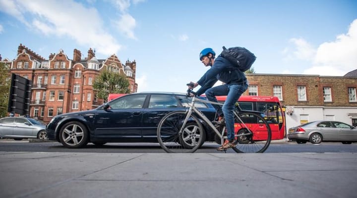
Lewisham's cycleway network has trebled in size (or has it?)
Transport for London hailed the increase in cycleways in Lewisham, but large parts of the "new" routes already existed.
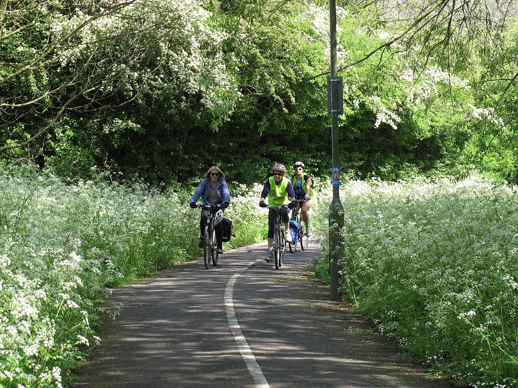
Transport for London (TfL) has completed work on two Lewisham cycleways, which they claim has trebled the cycle network in the borough, growing from “5.05km in December 2022 to 16.6km in October 2025”.
However, many of these routes already had some level of cycling infrastructure prior to 2022. The “new” cycleways are mainly upgrades to existing cycle networks that no longer meet TfL standards.
The two routes are Cycleway 18, running from Catford to Lower Sydenham, and Cycleway 66, from Forest Hill to Brockley. They can be found on TfL's cycle route map.
Marking the occasion, councillor Louise Krupski, Lewisham Council’s deputy mayor and cabinet member for Climate Action, Transport and Environment said: “We are delighted to see the completion of these major additions to the cycleway network in Lewisham, which mark a significant milestone in our journey towards being a healthier, greener borough.
"These improvements are a key part of our wider vision for active travel, where walking, wheeling, scooting and cycling become the default choice for everyday journeys.”
Will Norman, London's Walking and Cycling Commissioner, said: “Expanding London’s cycleway network is key to enabling more Londoners to choose cycling for shorter trips.
"These major new additions in Lewisham will help connect communities across the borough and support Londoners of all backgrounds and abilities to cycle safely as the Mayor continues building a fairer, safer, greener London for everyone.”
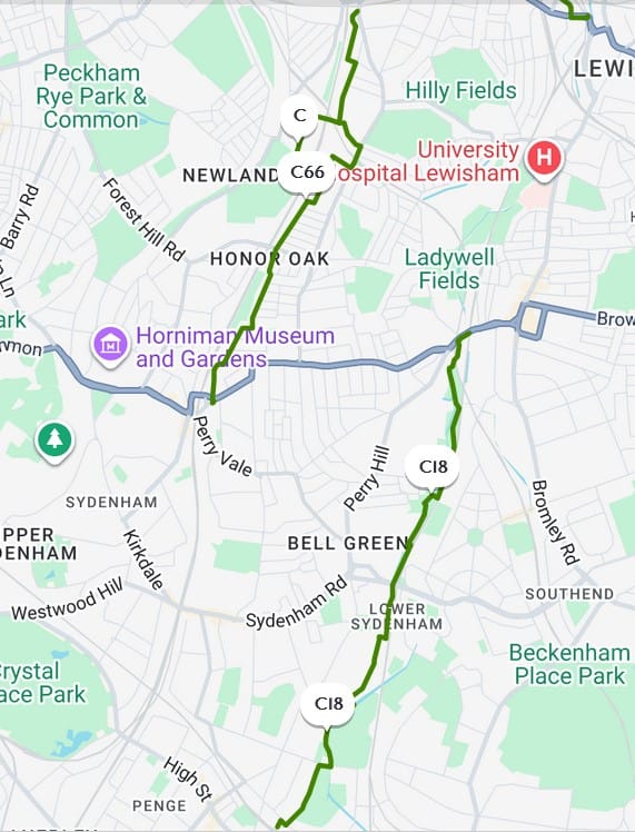
Cycleway 66 - Forest Hill to Brockley
Lewisham Cyclists told Salamander: “We are generally satisfied with the upgrades along this route. Three old fire gates have been removed and replaced with bollards which now allow cargo bikes and adaptive cycles to pass through.
"Also an on-pavement shared route has been signed in Crofton Park, which plugs a major gap in the route and allows less confident cyclists to avoid riding on the main road there.”
However, they noted, “There is one further improvement we would like to see and have requested – a Tiger crossing where the route crosses Honor Oak Park."
A tiger crossing is a type of of parallel crossing for cyclists next to a traditional pedestrian "zebra" crossing.
Cycleway 18 - Catford to Lower Sydenham
The group commented on this route: “The two main remaining weaknesses of this section of the Waterlink Way have always been the unprotected crossing of Southend Lane, and the narrow and hazardous ‘confluence’ wooden hump-backed bridge."
They noted that a toucan crossing, which allows pedestrians and cyclists to cross together, was recently been installed at Southend Lane and they had been advised that "works to replace the ‘confluence’ bridge with a new wide and accessible bridge should start in January 2026.
"The re-signage of the route as C18/WW/NCN21 is maybe a bit premature, but we’re not complaining if the bridge works proceed to schedule.”
Support independent, local journalism. Become a supporter or leave a tip.
Opportunities for future connections
Lewisham Cyclists is campaigning for a link between the two new cycleways, the Catford to Forest Hill (C2FH) cycleway.
“It would be a very useful safe walking and cycling route connecting Forest Hill and Catford town centres via many residential streets, some playing fields and several local schools.
"The Council have not made a full commitment to the route yet but have indicated a willingness to progressively ‘chip away’ at it. For instance they have recently made some main-road crossing improvements along the route.
"The main impediment to its full implementation are the significant costs associated with re-surfacing of the unadopted road Elm Lane which lies in the middle of the route.”
In October 2025, Lewisham formally approved its Active Travel Strategy (ATS). A segment of cycleway from Honor Oak Park to Sydenham, which starts at Honor Oak Park, heads south east and continues further south than Cycleway 66, was ranked as Priority 7.
Cycleway 18 is shown in the strategy document as an already existing active travel route.
Lewisham Cyclists said, “Apart from C2FH, C66 and C18, we look forward to the accelerated delivery of the safe cycling routes identified in the Lewisham ATS not only towards the south west of the borough, but also the south eastern corridor(s).
"This will require TfL funding and developer funding as well as capital funding from Lewisham Council.”
Louise Krupski said: “Our newly adopted Active Travel Strategy sets out a bold and inclusive roadmap for the next decade, ensuring that everyone in Lewisham, regardless of age or ability, can move around safely, confidently and sustainably.”
Poor score on Healthy Streets
In the 2025 Healthy Street Scorecards (HSS), Lewisham had the second lowest percentage of protected cycle lanes for all inner London boroughs, at 1.5%. Neighbouring Greenwich, despite being an outer London Borough, scored 4%, and Southwark achieved 6.1%.
The new cycleways will not improve this score, as Healthy Streets do not count cycleways without parallel roads. Cycleway 18 is predominately through a linear park, while C66 is not protected.
Lewisham Cyclists confirmed that they generally agree with the HSS methodology, but note that in relation to Cycleway 18 “this section of the Waterlink Way is quite problematic for alternative routes, as the two options are pretty hazardous, hilly and considerably longer.
"The Waterlink Way route in contrast is very direct, mainly wide, well-lit and with a highish footfall.”
Years' long upgrade project
Curious about the history of the roads, I utilised Google Street View to see the transformation of the cycleways at a few key intersections. It shows gradual improvements and upgrades to cycling infrastructure over many years, not just the last three years that TfL used to measure the increase in cycleways.
At the intersection of Lennard Road and Cator Park, the earliest available Street View from 2008, already had a pedestrian path through the park and included signs for cyclists. In 2022, the intersection upgrade and a two-way cycle path was added on Lennard Road.
Intersection Lennard Road. Image on left 2008 shows cycleways, 2022 on right shows upgraded infrastructure. Images: Google Street View
A bit further north, the pattern repeats. At Westerley Crescent, just next to Lower Sydenham station, infrastructure appeared in 2021.
Much of Cycleway 18 is utilising the Waterlink Way, which has existed for many years. A 2011 blog post from the Sydenham Society called it a “car-free cycling heaven”.
Cycleway 66 fares similarly. At the junction of Stanstead Road and Waldram Crescent (A205), in the earliest possible Google Street View from 2012, bikes are painted on the road, and a narrow bike lane appears to exist.
In 2025, a cyclehire parking space has been added, and the number 66 below the painted cycle.
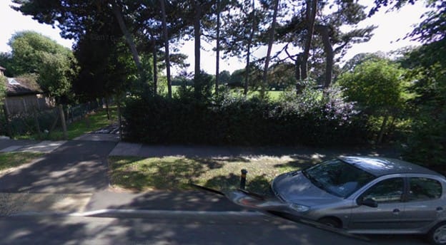
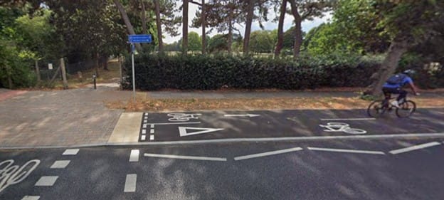
Further North along the route, a barrier blocking vehicular through traffic from Garthorne Road to Gabriel Street existed from the earliest of Google Street View in 2008. By 2025, the gate has been replaced by bollards and street signs added.
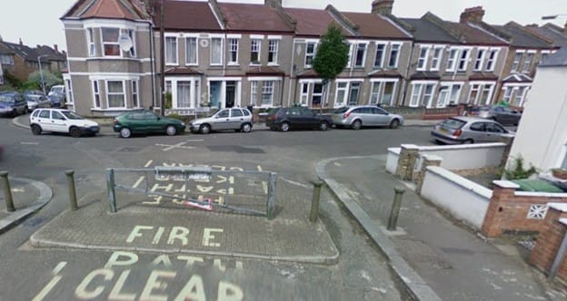
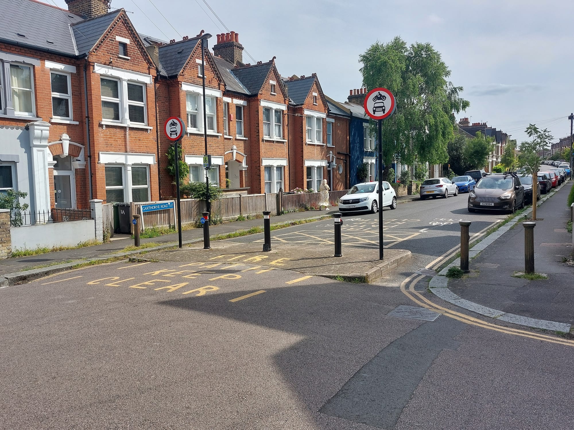
Garthorne Road to Gabriel Street. Image on left 2008 shows fire gate blocking vehicles; 2025 on right, fire gate has been replaced by bollards, signs added. Image 1: Google Street View, Image 2: Lewisham Cyclists
Buckthorn Bridge was another example where a car-free path was visible since the earliest street view, but access to the road leading to the path has now been further curtailed, with seating installed.
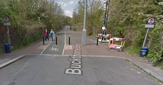
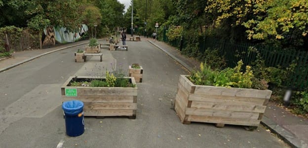
Buckthorne Bridge. Image on left 2008 shows car free path. 2025 on right, planters added, extending car free space. Images: Google Street View
Updated 19/11/25 at 16:40 with up to date image of Garthorne Road/Gabriel Road junction showing bollards.
Sign-up for our free weekly newsletter - Salamander News in your inbox
